
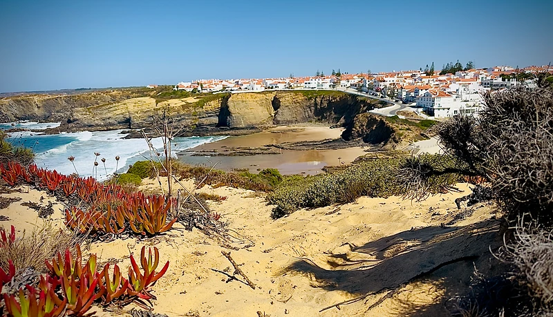
Fishermen's Trail Guide — São Torpes to Lagos | Rota Vicentina
The definitive stage-by-stage guide to the Fishermen's Trail — one of Europe's finest coastal long-distance hikes. 13 stages, 226.5 km, from the sands of São Torpes south of Sines to historic Lagos on the Algarve, following the wild Atlantic coast of the Southwest Alentejo and Vicentina Coast Natural Park.
Always verify current route conditions
Trail conditions, closures and ferry services can change. Before each stage, check the official Rota Vicentina information for the latest updates. Temporary warnings should never replace official sources.
Source: Rota Vicentina · Updated 2026-09-27
The Fishermen's Trail at a glance
Trail information last reviewed: 2026-09-27. Always verify current conditions with the official Rota Vicentina information before each stage.
All 13 stages
Click a stage for the full guide — distance, difficulty, terrain, beaches, food & water, what to see and luggage transfer booking. Detailed guides are being added stage by stage.
São Torpes Porto Covo
ModerateThe opening stage of the Fishermen's Trail runs 17 km from São Torpes beach, just south of Sines, to the whitewashed village of Porto Covo. It's a moderate half-day of walking — about 4h 30min — over dune paths, low clifftops and a couple of short sandy beach sections. The terrain is gentler than later stages and makes an ideal warm-up. Highlights include the sweeping sands of São Torpes, the island of Pessegueiro with its 16th-century fort ruin, and the first Atlantic clifftops where white storks begin to appear. Most hikers start here to acclimatise before the longer, sandier stages ahead.
Porto Covo Vila Nova de Milfontes
ModerateStage 2 covers 20 km from Porto Covo to Vila Nova de Milfontes in about 5h 15min — a moderate but long, sandy day. This is the classic 'beach section' of the Fishermen's Trail: extensive sands at Ilha do Pessegueiro, Aivados and Malhão open out before the first real cliffs appear, where white storks nest on the rocks. The persistent sand makes it tiring, and for most hikers it is their first full day on the trail. Plan for sun, wind and little shade, and aim to finish in Milfontes — the liveliest village on the trail — for a well-earned rest.
Vila Nova de Milfontes Almograve
HardStage 3 is the shortest walking day of the central section — 15 km, about 3h 45min — but it is rated Difficult for its clifftop terrain and short, steep ascents. It leaves Vila Nova de Milfontes along the Mira estuary and follows the coast past Brejo Largo beach and through acacia tunnels to the small village of Almograve. Despite the distance, the constant up-and-down of the clifftop path makes it a real workout. It is a perfect shorter stage to recover energy after the long day 2, with some of the prettiest cliff scenery on the trail.
Almograve Zambujeira do Mar
ModerateStage 4 is the longest of the central Fishermen's Trail: about 22 km and 5h 50min from Almograve to Zambujeira do Mar. It is rated Moderate rather than Difficult because most of it is firm clifftop and cart track, but the distance, soft red sand and sun exposure make it a full day. The reward is dozens of near-empty coves, the artisanal fishing harbours of Lapa de Pombas and Entrada da Barca, a stork colony on the cliffs, and the cape of Cabo Sardão. Most hikers call it one of the most beautiful days of the whole trail.
Zambujeira do Mar Odeceixe
HardStage 5 is the most demanding of the southern Alentejo section: about 19 km and 5h 40min from Zambujeira do Mar to Odeceixe, rated Difficult for its repeated steep climbs and sandy, exposed clifftops. It passes the beaches of Alteirinhos, Carvalhal, Machados and Amália and the fishing hamlet of Azenha do Mar, and it ends with one of the signature views of the whole Fishermen's Trail: Odeceixe beach and the Seixe river mouth, seen from the top of Ponta em Branco.
Odeceixe Aljezur
HardStage 6 is the longest day of the southern Fishermen's Trail: about 23 km and 5h 50min from Odeceixe to Aljezur. It starts by following the Seixe river valley, one of the most emblematic places on the Rota Vicentina, then climbs onto the cliffs for a beautiful stretch of coast to Rogil, where the route joins the Historical Way and turns inland to finish in Aljezur. It is rated Difficult because of the distance and the mix of valley, cliff and inland terrain.
Aljezur Arrifana
ModerateStage 7 is a gentler day: about 17 km and 4h 46min from Aljezur to the cliffs of Arrifana, rated Moderate. It leaves the town inland, crosses farmland and low hills, and reaches the coast near Arrifana, a surfing hotspot with a spectacular beach framed by black rocks and dramatic Atlantic views. It is a good day to recover after the long stage 6 and to enjoy the village at the end.
Arrifana Carrapateira
ModerateStage 8 runs about 18 km and 5h 10min from Arrifana to Carrapateira, rated Moderate. It follows the wild west coast of the Costa Vicentina natural park, passing the beaches of Vale Figueiras and Monte Clérigo and reaching Carrapateira, a quiet village between two superb beaches, Bordeira and Amado. Expect cliffs, dunes and long open views with very few other walkers.
Carrapateira Vila do Bispo
HardStage 9 is the longest stage in the southern half: about 22 km and 6 hours from Carrapateira to Vila do Bispo, rated Difficult. It follows the dramatic cliffs of the Costa Vicentina past Praia do Castelejo and Praia da Cordoama, then turns inland across open heathland to the small town of Vila do Bispo. There is very little shade or water on the route, so it needs careful preparation.
Vila do Bispo Sagres
EasyStage 10 is an easy, rewarding walk of about 14 km and 4 hours from Vila do Bispo to Sagres, near the south-western tip of Europe. It crosses open countryside to the coast, passes Praia do Martinhal and Praia da Ingrina and reaches the fortress headland of Sagres, the symbolic end of the western Algarve. Rated Easy, it is a short, scenic day with time left for the lighthouse of Cabo de São Vicente.
Sagres Salema
ModerateStage 11 runs about 17 km and 5 hours from Sagres to Salema, rated Moderate on paper but demanding in practice, with steep ups and downs between beaches (the Rota Vicentina describes it as one of the most challenging stages of the Fishermen's Trail). It follows the cliffs of the Sagres peninsula and the coast of the Algarve, passing Praia da Ingrina and Praia da Boca do Rio and reaching Salema, a former fishing village now popular with walkers and holidaymakers. The Atlantic gradually becomes calmer and warmer as you head east.
Salema Luz
EasyStage 12 is a short, easy coastal walk of about 11 km and 3 hours from Salema to Luz, rated Easy. It follows the eastern Algarve cliffs past Praia da Boca do Rio and Burgau, with calm bays and whitewashed villages along the way. It is the gentlest day of the trail, with plenty of time to swim, stop for lunch and enjoy the sea.
Luz Lagos
EasyStage 13 is the final, easy stage of the Fishermen's Trail: about 13 km and 3 hours 30 minutes from Luz to Lagos, rated Easy. It follows the golden cliffs and sandy coves of the Algarve, passing Praia do Porto de Mós and the old Ponta da Piedade headland, and finishes in the historic town of Lagos. It is a celebratory last day with calm sea, beaches and the best of Algarve scenery.
About this guide
This Fishermen's Trail guide is maintained by Hike Easy, a local luggage and hiker transfer operator working along the Rota Vicentina. We created it to help hikers plan a safe, enjoyable walk — the guide serves hikers first and promotes our services secondarily.
Hike Easy is a registered tourism operator (RNAAT) and an official partner of the Rota Vicentina project. We are not the official trail authority — always verify temporary route conditions, closures and ferry services with the official Rota Vicentina information before each stage.




Walk the Fishermen's Trail light
Book luggage transfers for any stage — or the full trail — and walk with just a daypack.
Looking for the inland route?
Historical Way Guide →